

El Morro Project
Summary: The El Morro project partially covers mineralized structures and their extension under the pediment within the Sombrerete - Fresnillo - Zacatecas - Cerro San Pedro districts portion of the Mexican Silver Belt in central Mexico. (see map)
Minas Año Tres Mil, S.A. de C.V. (MATM) is looking to option 100% of the project.
Background: The Sombrerete-San Martín-Sabinas (>31,000 t Ag), Fresnillo (48,500 t Ag), Zacatecas (>31,000 t Ag), and Cerro San Pedro (~4 million oz. Au) deposits/districts are aligned within the San Luis - Tepejuanes portion of the Mexican Silver Belt. (see map) Within this alignment of major districts, and some 60 km to the southeast of Zacatecas is MATM’s El Morro project in the Pánfilo Natera district. The project consists of ~1,200 hectares that partially cover mineralized structures and their projected extension under the pediment to the East and into a graben. Most of the area of primary interest is covered by transported overburden. Mineralization where exposed consists of Ag-Pb-Zn-(Au) in quartz-calcite veins with weak to no alteration envelopes in a late Cretaceous granodiorite. It is believed that this mineralization may represent the roots of a larger system that has been eroded away. However to the East the district is terminated by an extensive graben where the upper parts of the mineralized system should be preserved. The target is an epithermal deposit similar to Fresnillo or Zacatecas within this graben. There is also the possibility of a skarn and/or stockwork deposit similar to Cerro San Pedro.
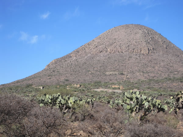
Overview of Cerro El Morro showing old workings and camp in the foreground.Results: Only 22 rock samples have been taken to date by MATM, both on ground covered by MATM’s concessions and concesion applications and on neighbouring concessions. All samples were select samples of quartz, jasperoid or calcite vein material from float and dumps. Values range from <0.001 to 0.923 g Au/t, 0.1 to 647 g Ag/t, 10 to 18,950 ppm Pb, and 9 to 8930 ppm Zn. Published work by others on neighbouring concessions returned anomalous values of Ag, Pb, Zn and Hg in soil associated with known structures. The anomalies are open towards the graben and MATM’s concession applications.
Recommended Program: A geophysical survey to map the graben boundary and depth to bedrock along with a deep penetrating geochemical survey should be completed to the East of the known mineralization. Any anomalies found should be followed up by geophysical surveys, and if warranted they should be tested by drilling.
Agreement: MATM owns 100% of the concessions and concession applications. MATM is looking to option 100% of the project, subject to a NSR. A geologic report and data package is available on signing a confidentiality agreement.
For more information contact us.
This page last updated
November 11, 2018
Copyright © 2012-2018, Y3K Exploration Company LLC All rights reserved. ![]()
![]()